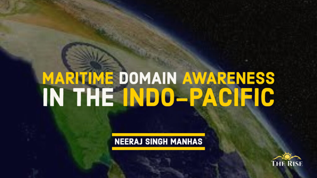
Even in today’s globalised and technologically advanced world, most goods are still transported by sea. Most physical items, whether manufactured goods, construction materials, food, and fuel, still rely on standard shipping through sea lanes to reach their markets. Similarly, international security continues to prioritize the seas. Ships are still required for the majority of military equipment and almost all logistical support. Given the globalization of the world economy and the resulting globalization of threats, even continental powers that have traditionally relied on land power rather than sea power now rely on the world’s oceans. In this light, maritime domain awareness—keeping an eye on the world’s oceans and waterways—is a critical matter of security with significant economic and military implications. This is especially true for the members of the so-called Quad—Australia, India, Japan, and the United States—the Indo-Pacific’s democratic nations. As maritime powers, they rely on the seas for survival; thus, any threat to the safety and security of the world’s sea lanes directly threatens their national security.
The Indo-Pacific Partnership for Marine Domain Awareness (IPMDA) is a new maritime domain awareness programme aiming to collaborate with regional partners to respond to humanitarian and natural catastrophes and prevent illegal fishing.
At the summit on May 24, 2022, the Quad leaders described the IPMDA as “embodying what the Quad stands for: catalyzing our collective efforts towards concrete results that contribute to a more peaceful and prosperous region.”
The introduction of the IPMDA was accompanied by a great deal of attention, both in the form of official declarations and media commentary. However, it is necessary to evaluate the initiative’s contribution to India’s goals. On the one hand, the IPMDA is expected to transform “the ability of partners in the Pacific Islands, Southeast Asia, and Indian Ocean region to fully monitor the waters on their coastlines and, consequently, to support a free and open Indo-Pacific”. On the other hand, it has been indirectly related to China’s intimidating behaviour aimed to thwart China’s efforts to construct ‘security perches’ in the Pacific Islands, planned to monitor China’s ‘grey zone’ maritime activities, and enable tracking of ‘black ships’. This piece aims to clarify the IPMDA from India’s standpoint.
Geographical Range
The first aspect to consider is the initiative’s geographical scope. “The IPMDA will develop a faster, broader, and more accurate picture of near-real-time maritime activity in partner waters. This unified operational picture will combine three important regions in the Indo-Pacific: the Pacific Islands, Southeast Asia, and the Indian Ocean region”. The absence of East Asia is glaring, but we understand that the United States and Japan already possess a comprehensive MDA picture of the East China Sea.
The IPMDA’s coverage in the Indian Ocean looks to be limited. According to the fact sheet that accompanied the announcement by the leaders, four current Information Fusion Centres will be linked in Gurugram, Singapore, the Solomon Islands, and Vanuatu. The connection to the Regional Maritime Information Fusion Centre in Madagascar which is run by France and the EU among others is absent. Connectivity to either the MDA component of US Operation Sentinel or the European Maritime Surveillance Mission in the Straits of Hormuz is also essential (and Bab-el-Mandeb). At a time when India has placed a liaison officer at NAVCENT Bahrain and joined as an observer the Indian Ocean Commission, the Djibouti Code of Conduct, and the Coalition Maritime Force in Bahrain, this exclusion becomes glaring.
Also Read: China’s South China Sea Claims Threaten India’s Economic and Geopolitical Interests
India has emphasized to the United States that arbitrarily dividing the Indian Ocean into two halves to meet US Command lines is not feasible. Currently, the IPMDA seems to be coterminous with the Area of Responsibility of US INDO-PACOM
This indicates that the IPMDA is currently coterminous with the Area of Responsibility of US INDO-PACOM, the principal US agency responsible for its implementation. India has emphasized to the United States that arbitrarily dividing the Indian Ocean into two halves to meet US Command lines is not feasible. It is possible that India will be able to link the western half of the Indian Ocean in the future. Nonetheless, the fact that the IPMDA, as it currently stands, only partially covers India’s maritime rights in the Indian Ocean is an obvious drawback.
Monitoring Dark Shipping
The International Maritime Organization (IMO) mandates that all ships with a displacement of over 300 tonnes and engaged in international voyages (and all cargo ships with a displacement of over 500 tonnes, regardless of whether they are engaged in international voyages) must be equipped with an Automatic Identification System (AIS). Essentially, the device permits vessel identification and tracking (including by satellites). Designed initially to prevent collisions, AIS also enables the surveillance of national merchant and fishing fleets, cargo tracking, infrastructure protection, search and rescue, and EEZ security.
The use of AIS for security is hindered by two obstacles. First, vessels in flouting penalties turn off their AIS transponders thereby “going dark.” Second, they engage in spoofing which involves altering their response code to impersonate another vessel. This identity shift occurs at sea: a ship displaying an incorrect response code in port is likely to be detected by port authorities due to the linkage between visual/electronic and AIS inputs. Since most monitoring systems cannot maintain 24-hour surveillance over the open ocean, the ‘spoofer’ is able to escape.
Technological advances offer a potential answer to both problems. Satellites enable the receiving and continuous monitoring of all vessels’ AIS signals. The usage of artificial intelligence should enable electronic identification and flagging of the instant when spoofing begins. Synthetic aperture radar that will be utilized by the NASA-ISRO NISAR satellite to be launched by India in January 2023, has the ability to see through clouds, allowing for improved radar surveillance of all vessels, including those that have “gone black.” The challenge has thus far been the availability of affordable satellite data. This can be circumvented if the IPMDA programme covers the expenses or provides the necessary satellite coverage.
The territory to India’s west is not covered by the IPMDA, despite the fact that India has an interest in tracking dark shipping utilized for terrorist objectives and emanating from its western region.
Also Read: Indian Ocean and South China Sea: Jugular Vein as Gordian Knot
Who will respond and for what reason is the tracking of dark freight conducted? One of the key objectives is to combat sanctions evasion, including both UN and US-issued restrictions, such as those imposed on Iran and Russia. The territory to India’s west is not covered by the IPMDA, despite the fact that India has an interest in tracking dark shipping utilized for terrorist objectives and emanating from its western region. In contrast, the United States has an interest in monitoring all dark shipments, including combating the evasion of unilateral sanctions.
The nations of Southeast Asia, the Southern Pacific, and the Indian Ocean lack the capacity and motivation to respond to China’s violation of their economic zones. In May 2019, the Chinese vessel Haijing 35111 worked near a Shell-chartered drilling vessel in Malaysia’s Luconia Shoal before transferring operations to Vietnam’s Block 06-01. In both instances, China was able to discourage the maritime forces of the affected nations from responding. The US Navy was responsible for protecting Shell’s interests in the initial case. It seems improbable that the United States will retaliate in the Indian Ocean because of the absence of a consistent presence. Even in the remaining coverage area, the consequences of a US response to incursions within the territorial zones of smaller island governments must be considered. As the IPMDA’s precise systems for tracking dark shipping take shape, India will need to be vigilant to protect its own interests.
IUU Fishing
China is by far the largest consumer of fish from the world’s oceans. In June of 2020, it was predicted that its long-distance fishing fleet consisted of 16,996 vessels, which is five to eight times the projections. Another report found the region surrounding Seychelles and Mauritius as the most susceptible to IUU (Illegal, Unreported and Unregulated) fishing, despite the fact that this region is not covered by the IPMDA.
India, Bangladesh, Myanmar, Indonesia, and Thailand – all maintain adequate surveillance and response capabilities in their respective maritime zones within the Indian Ocean section of the IPMDA. IPMDA will bring a nice but modest benefit. Smaller island states in the Central and Western Indian Oceans have the greatest need for the IPMDA. India must determine how to provide them with its benefits. Notably, the IPMDA does not currently seek to encompass other transnational crimes, such as piracy, terrorism, drug, firearm, and people trafficking. Perhaps these regions will be explored in the future.
The IPMDA does not currently seek to encompass other transnational crimes, such as piracy, terrorism, drug, firearm, and people trafficking.
Conclusion
Following the terrorist attacks of September 11, 2001, the United States announced its National Plan for Maritime Domain Awareness. According to the then President of the United States, George W. Bush, the core of the Maritime Domain Awareness programme is accurate information, intelligence, surveillance, and reconnaissance of all vessels, goods, and persons far beyond our traditional maritime boundaries. Since then, the United States has pursued MDA with tremendous vigour. The IPMDA significantly facilitates the networking of the Indo-Pacific strategic picture as described by the United States.
The knowledge gathered by IPMDA will undoubtedly aid in the development of comparable connections with the Arabian Sea and the Eastern Indian Ocean.
After the 26/11 terrorist attacks in Mumbai, India commenced construction of its regional domain awareness infrastructure. The necessary infrastructure is currently well-developed, but because of the continuity of the oceans, it would be advantageous to join up with comparable structures to India’s east and west. The knowledge gathered by IPMDA will undoubtedly aid in the development of comparable connections with the Arabian Sea and the Eastern Indian Ocean.
The Quad partners have pledged to initiate urgent consultations with regional partners and to identify promising future technologies so that the IPMDA may continue to be a cutting-edge cooperation that promotes peace and harmony in the area. It is hoped that these consultations will solve some of the deficiencies outlined above, enabling the IPMDA to produce truly concrete results that will make the region safer and more affluent.
In any case, a solid foundation has been laid for integrating capabilities with the objective of advancing the IPMDA idea throughout the region. This might become a crucial stepping stone toward a comprehensive, shared marine strategy picture that advances the security objectives of the Quad partners in the Indo-Pacific.
Disclaimer: The views expressed in this article are of the author solely. TheRise.co.in neither endorses nor is responsible for them.
About the author
Neeraj Singh Manhas is a Director of Research, Indo-Pacific Consortium, at Raisina House, New Delhi. He has authored four books under his name and has various research interests covering India-China in the Indian Ocean, India's maritime securities, and Indo-Pacific studies.


Pingback: I2U2 and its Significance in the Indo-Pacific - TheRise.co.in